-
SECTION 1
Riparian Land
Riparian land is land that is connected to a waterway.
Riparian land can be connected to the waterway by proximity (a riverbank) or by water flow (a floodplain).
Waterways can take many forms. They include rivers, streams, creeks, wetlands, lakes, billabongs and drainage lines. Some waterways remain dry for prolonged periods, and only contain water after heavy rain events.
There are many reasons why riparian land is important.
Healthy riparian land helps keep sediment and nutrients out of our waterways and supports biodiversity. These functions provide us with clean drinking water for people and stock, and the ability to enjoy activities like swimming, kayaking and fishing. They also create special places where we can experience a strong connection with nature.
Healthy riparian land creates a micro-climate that benefits stock, wildlife and fish by reducing air and water temperatures in hot weather, and buffering icy winds and rain when it is cold.
Healthy riparian land also plays an important role in reducing the effects of climate change. Riparian soils and leaf litter store large amounts of carbon (hence the expression ‘rivers of carbon’), and are significantly better at reducing nitrates than terrestrial soils.
Healthy riparian land supports a vast number of plants, animals, insects and other organisms which all work together to keep the waterway and its banks in good condition.

How much riparian land is on your property?
The amount of riparian land connected to a waterway will depend on:
- the size and type of the waterway;
- whether the waterway is permanent;
- topography.
The riparian land of a river that is prone to flooding will include its floodplains, which may extend several hundred metres either side of the riverbed. In contrast, the riparian land alongside a narrow creek may be less than 15m wide.
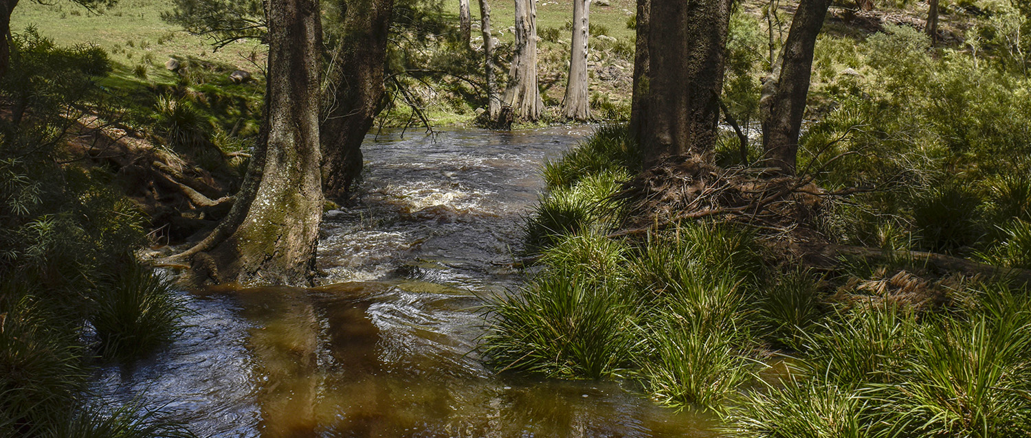
The following photographs illustrate just a few of the different types of waterways and riparian land that may exist on your property.
Different ways of assessing the health of your riparian land are described in Section 10. If your assessment indicates that your riparian land is not in good condition, removing stock is the quickest and easiest way to restore its health.
 sml")


As these photos show, there are many different types of riparian areas. We discuss the economic and environmental costs of poor management in Section 2.
Download a PDF copy of Section 1: Riparian Land.
Fill in the form below and we’ll send you a digital copy.

We have incentives available for managing stock around waterways on your farm…
Through our Rivers of Carbon program we can help you manage stock around waterways. We will visit your property and work with you to develop a plan for your waterway that may involve fencing, off-stream water, small-scale erosion works, and re-vegetation.
Once we have an agreement in place on what we want to achieve together, we generally cover at least half of the costs involved in implementing the agreement. Click the button below to learn more about our program:

This website is a collaborative project between:
